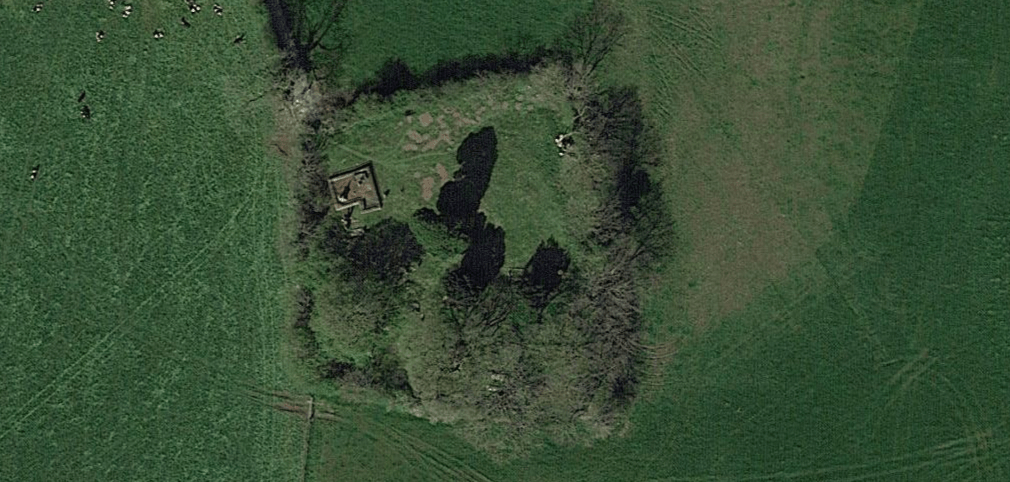
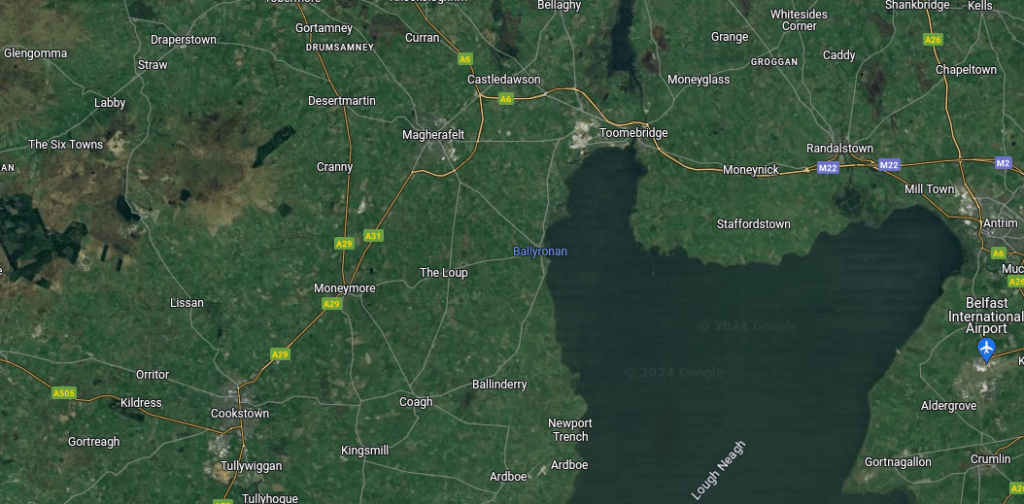
Ballyeglish Old Graveyard is located in County Derry in north-eastern Ireland, close to the village of The Loup which is to the west of Lough Neagh, the largest lake in The Celtic Isles. The site lies south of the B18 road which itself runs between the villages of The Loup and Moneymore.
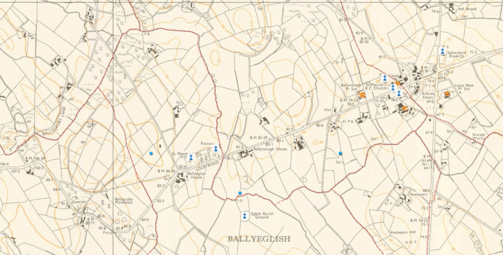
The following maps will help to more easily locate Ballyeglish Old Graveyard. In this first map, it is shown beside a cross, to the right of centre in the lower half of the image, and is titled “Eglish Burial Ground.”
In the second map, the site is marked with a blue cross (not on the original) and is bottom centre, titled “Eglish Burial Gd.” The lane from the road to the site is also marked.
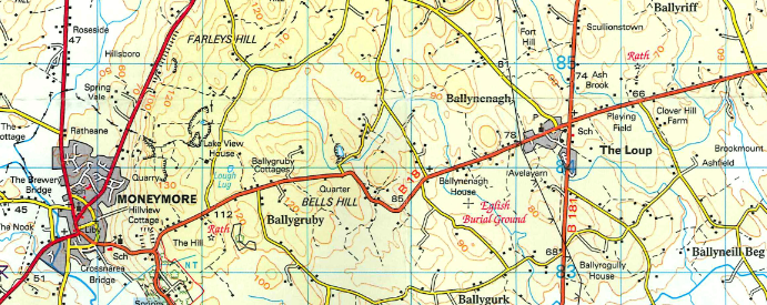
In this third map, the site is positioned as before, this time titled “Eglish Burial Ground,” and the access laneway is not delineated, as only field boundaries are shown.
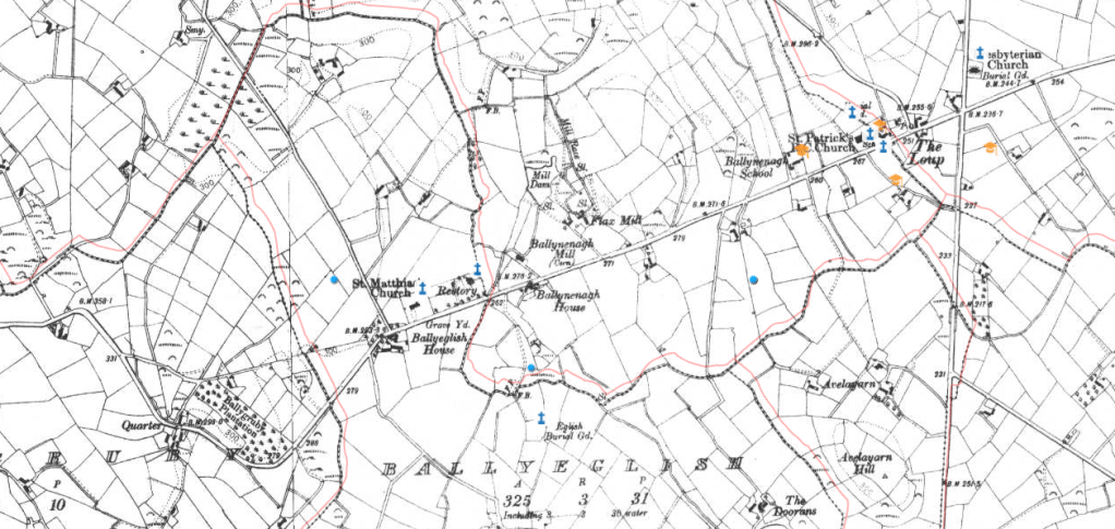
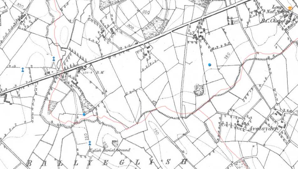
The next map dates to between 1846-1862. “Eglish Burial Ground” lies to the bottom and left of centre and has a blue cross to the top right of the marked graveyard. This earlier map is interesting as it clearly shows the access route from the road to the site, which has an elbow bend closer to the public thoroughfare, but which has been since removed.
Those familiar with the area might notice the location of both the Catholic Church and National school in the top right corner of the map. This is the location of the 1771 church erected by Rev. Anthony Conwell, buried at Ballyeglish Old Graveyard. Penal Laws, still in place at that time, meant that Catholic places of worship (known officially as “mass houses” as the term “church” was reserved for the Anglican denomination) were not permitted to be built alongside main roads. The current Catholic Church was built close by, in 1864, along the northern side of the B18 road, and its adjoining graveyard was used from that time, although the “Old Graveyard” at Ballyeglish was still in use into the latter decades of the 20th Century for both Catholic and Protestant burials.
St Matthias’ Anglican Church is not shown as it was built in 1868, after this map was drawn. Later maps also show the nearby rectory associated with this place of worship.
– Note: the blue cross and dots shown are not on the original maps, but show newly added points of interest –
The National School is also gone from that location and, today, St Patrick’s primary school sits above the B181 Rousky Road, not far from where local children learned their three “R’s” (Reading, wRiting, and aRithmetic) in the 1800’s
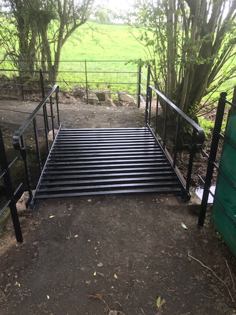
There is a Public Right of Way vehicular lane which will take visitors from the public road to a small parking area adjacent to a picturesque stream. A short, stoned path then runs along the stream to a metal footbridge over the watercourse. It has black railings on either side to prevent visitors from taking a tumble and getting their feet (and everything else) wet.
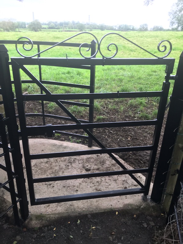
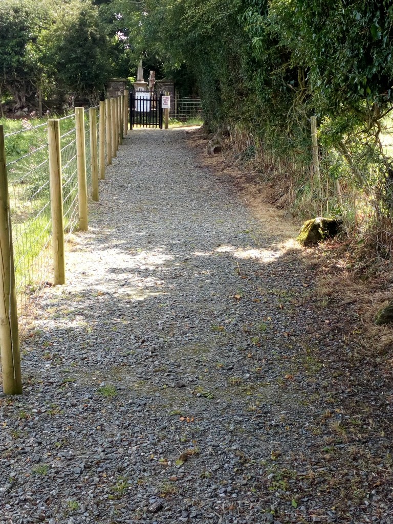
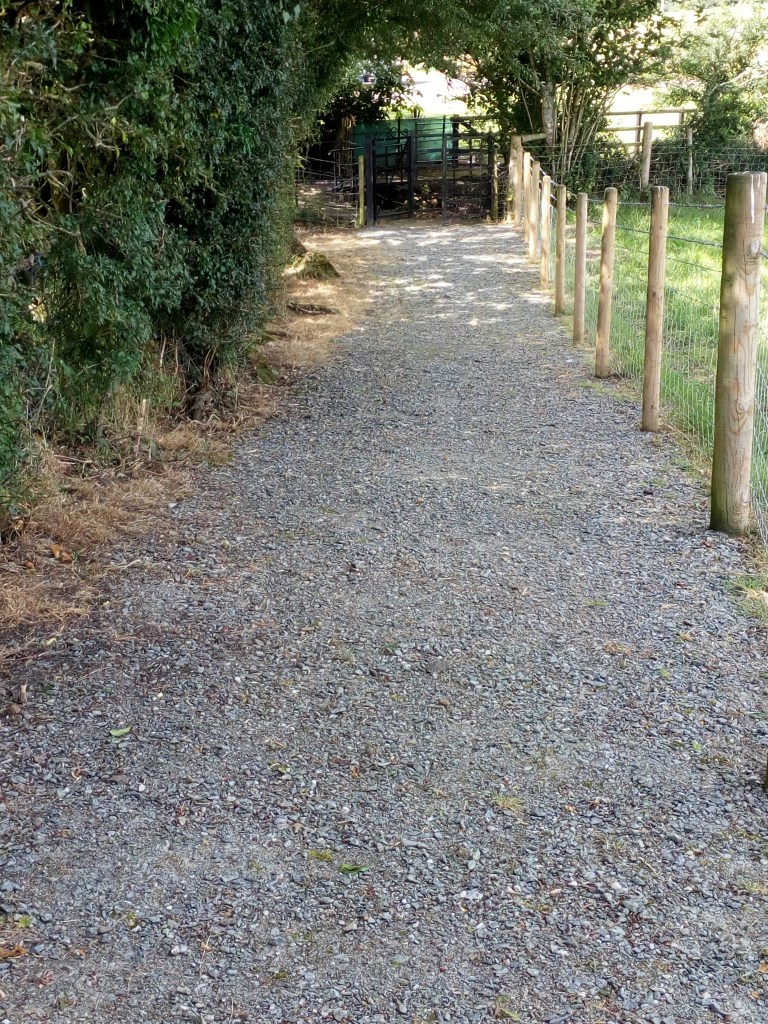
Next, along the route, we see a fine example of a kissing gate. This one provides (human) access to a fenced and stoned pathway that leads up a slight incline to the main (regular) gate at the graveyard. Mid Ulster District Council, assisted by local volunteers, maintain the pathways and graveyard with regular grass cutting, clean-up, and weed control. Eagle-eyed observers will note that the photo of the kissing gate, shown, was taken prior to the pathway to the graveyard being fenced and stoned.
Here you can see the fenced pathway that leads directly from the kissing gate to the graveyard.
We hope that the above provides all of the directions that you will need to visit this beautiful location. If you have any other questions, then please drop us a line at the email address given in Contact.
Bígí linn

